### Description
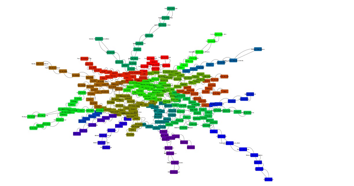
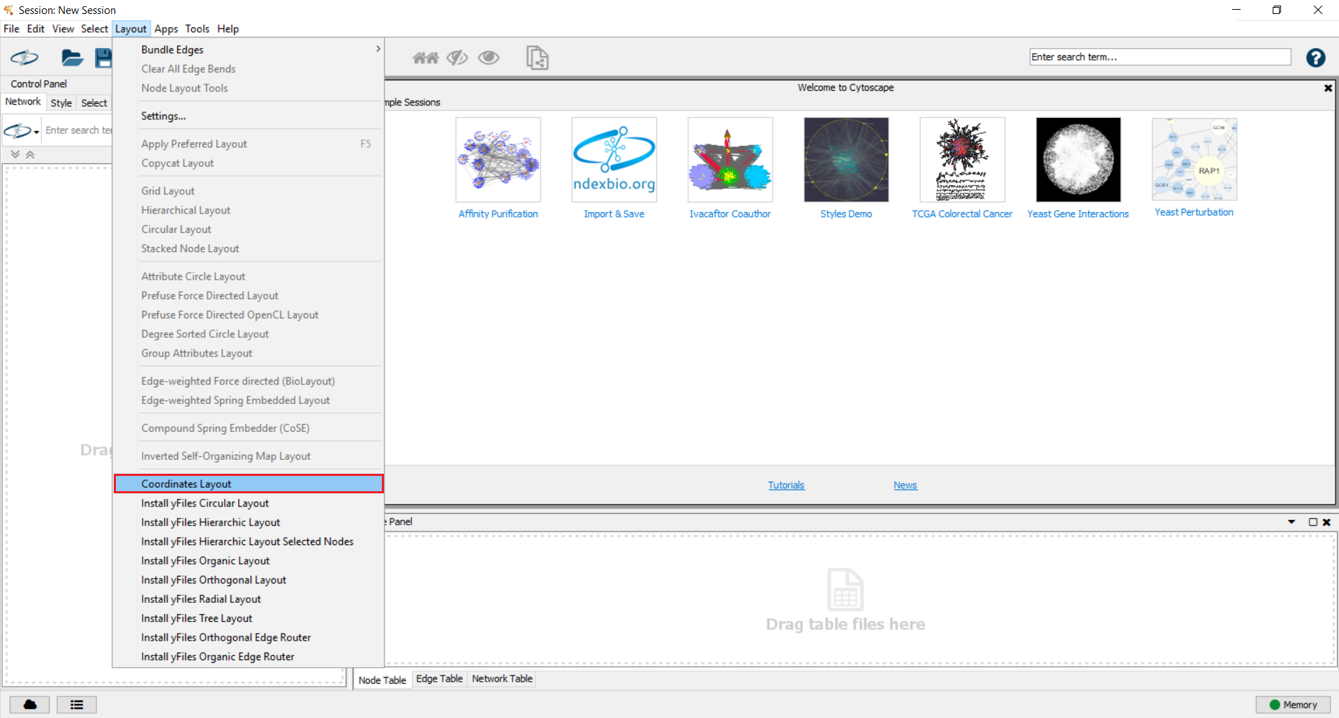
This plugin makes possible to open a graph by locating its nodes according to GPS coordinates. Once installed you can find it in the "Layout" menu. The plugin needs the following information:
* Nodes file composed of : numberNode labelNode cluster Xcoor Ycoor
* Edges file composed of : numberNode_1 numberNode_2 ~weight (the weight is optional)
* Name of the network you want to create
where the node and edge files are csv files, with spaces as separators. After entering these information, a network will be created and will print the graph. Nodes will be located according to their GPS coordinates and all nodes in the same cluster will have the same color.
### Code example
**Nodes file :** nodes_cluster_coors.csv
1 Node_1 1 41.083196 -73.673473
2 Node_2 1 41.056096 -73.60577
3 Node_3 2 40.873599 -73.968682
4 Node_4 2 40.858399 -74.075185
5 Node_5 3 41.207894 -74.020885
**Edges file :** edges_weight.csv
1 2 10
1 3 2
3 4 15
2 5 3